UN
9 The Dell
£ 147,000
Description
We don't have a Description for this property.
- Bedrooms
- 2
- Bathrooms
- 0
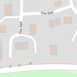


Leaflet © OpenStreetMap contributors
The heatmap indicates the level of crime in the area. The color of the heatmap indicates the crime severity and recency.
Metrics Year-on-Year
- Average area value
- 354,117.00 £Increased by 8.67 %
- Average area rental value
- 1,245.00 £/moDecreased by 2.96 %
- Est rental Yield
- 4.22 %Decreased by 10.59 %
- Crime Rate
- 5.00 %Unchanged by 0.00 %
from 325,861.00 £
from 1,283.00 £/mo
from 4.72 %
from 5.00 %
Nearby Schools
| Name | Type | Ofsted | Distance |
|---|---|---|---|
| Wigmore Primary | Community School | Good | 1.07 KM |
| Cockernhoe Endowed Cofe Primary School | Voluntary Aided School | Good | 1.23 KM |
| Queen Elizabeth School | Foundation School | Good | 2.02 KM |
| Someries Infant School | Foundation School | Outstanding | 2.14 KM |
| Someries Junior School | Community School | Good | 2.18 KM |
Images
Nearby Streets
| Name | Average Price | Average Sqft | Distance |
|---|---|---|---|
| President Way | £ 0 | 0 | 0.00 KM |
| Brierley Close | £ 375,000 | 0 | 0.00 KM |
| The Green | £ 1,000,000 | 0 | 0.00 KM |
| Gresham Close | £ 340,000 | 0 | 0.00 KM |
| Stony Lane | £ 2,850,000 | 0 | 0.00 KM |
Nearby Transport
| Name | NLC | TLC | Distance |
|---|---|---|---|
| Luton Airport Parkway | 3645 | LTN | 3.85 KM |
| Luton | 1536 | LUT | 5.48 KM |
| Harpenden | 1543 | HPD | 8.31 KM |
Nearby Listings
| Address | Price | Type | Score | Distance |
|---|---|---|---|---|
| Bowbrookvale, LUTON, Bedfordshire, LU2 | £ 380,000 | BUY | 8 / 10 | 0.16 KM |
| Bowbrookvale, Luton | £ 380,000 | BUY | 7 / 10 | 0.16 KM |
| Bowbrookvale, Luton, LU2 | £ 380,000 | BUY | 7 / 10 | 0.16 KM |
| Emmer Green, Luton, Bedfordshire, LU2 | £ 550,000 | BUY | 7 / 10 | 0.18 KM |
| Corbridge Drive, Luton, Bedfordshire, LU2 | £ 375,000 | BUY | 6 / 10 | 0.24 KM |
Nearby Properties
| Address | Price | Distance |
|---|---|---|
| 17 The Dell | £ 158,000 | 0.00 KM |
| 26 The Dell | £ 174,000 | 0.00 KM |
| 27 The Dell | £ 285,000 | 0.00 KM |
| 33 The Dell | £ 115,000 | 0.00 KM |
| 15 The Dell | £ 127,000 | 0.00 KM |